 |
Torca; Circular shaped depression caused by the collapse of a cave also a karst topography. This is a landscape because of Rocks dissolution due to rain and wind erosion and it is characterized by underground drainage systems with sinkholes, dolines, and caves. It has also been documented for weathering-resistant rocks. Subterranean drainage may limit surface water with a limited number of rivers or lakes. Well at this point let's go backward in time to the Mesozoic Era or Secondary, this period stands from 250 million years ago until about 65 million years. In this Era when vertebrates evolved and diversified on Earth, it can be divided into three periods; - The Triassic from 250 to 213 million years approx. living animals from earlier times among others Ammonites, Trilobites, Fish, Seaweed, Shellfish, etc. - The Jurassic from 213 - 144 million years; The Dinosaurs appear among other living beings and a third period that we call - Cretaceous, from 144 to 65 million years ago. Here's a great extinction which wipes out Saurios, but allows other small vertebrates whose evolution path after some steps would open the genus Homo. |
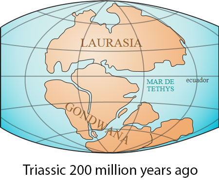
Well, once located where we are ... when Dinosaurs ruled the planet, the entire strip of the Andalusia nowadays at hand was submerged beneath the waters of the Tethys Sea. On these bottons were accumulating carbonate sediments that later shall originate so common in limestone Beticos subsystems, like here in the Torcal. |
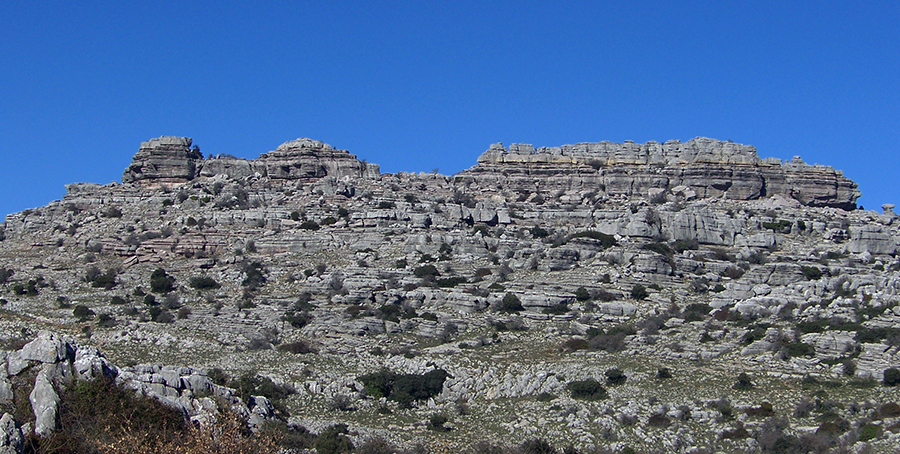
But it was not until long after the extinction of Dinosaurs, during the stage of Alpine folding, in which African and Eurasian plates collide, they are compressed and break all these materials accumulated at the bottom, emerging many hundreds of meters above the sea. As we see in the header image. Where sediments are seen in overlapping layers, which they were to accumulate over millions of years. Together with the remains of animals, especially fossilized shells that remain indelible to this day. Throughout the time outdoors, on the limestone water accumulates through cracks and dissolves the calcium carbonate. This acidified water when enriched in carbon dioxide, filtered through soil, reacts with carbonate to form bicarbonate, which is soluble. Giving karst landscape in surface by deep canyons and vertical, sunken land and of different sizes, torques, fanciful shapes distinguished by water erosion creating unstable rocks and ruts known as lapiaz, as we said before, etc. |
 |
 |
 |
All this training phase of the Torcal take us approximately from the Jurassic to about 18 million years ago. This transformation of forces between plates, and various orogeny (geological process by which the earth's crust shortens and folds into an elongated area of a push product), together with the elements of rain, wind and ice are changing the structure up to the capricious forms as we recognize today as Torcal. |
 |
 |
In the image above the supercontinent Pangea 240 million years ago |
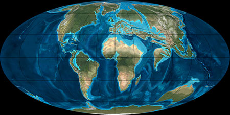
Pangea 150 million years ago |
 |
 |
The continents are delimited 50 million years ago |
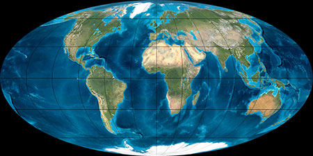
The distribution of the Earth and continents today |
In last 600.000.000 years the Earth's climate on a global scale has generally been much warmer than today. In those days there were no caps near the poles, the polar seas were open and there was not even the highest glaciers in mountain ranges. Climate change.
The Torcal access. Once we reach by road to the vicinity, either from Antequera by road C-337 to the MA-9016, or from Malaga on the A-45 to Casabermeja and the MA-436 to Villanueva de la Concepción and finally MA-9016, we found a parking and visitors area with information about, and a cafeteria. From here, the Torcal have three entries; One to a balcony where you can see a vast landscape almost to the sea coast, also show us the broken terrain produced by the collision of tectonic plates, the valley of Campanillas River, different streams, towns and in the distance, you can spot in the clear days the foothills of Sierra Nevada. To visit the karst area; the other two entries; one of 1,440 m long and 2750 m. Marked green and yellow respectively. Both very interesting indeed. |
jesúsf&Translation
